Four ideas for days without a castle visit
A holiday in Mühlberg is not only about the royal castles. Around Schwangau there are also days when lakeshores, walking routes and views matter more than guided tours and tickets.
The advantage is that these destinations are close together. Depending on weather, mood and length of the day, you can decide easily where to go.
Four destinations around Mühlberg
 5.2 km
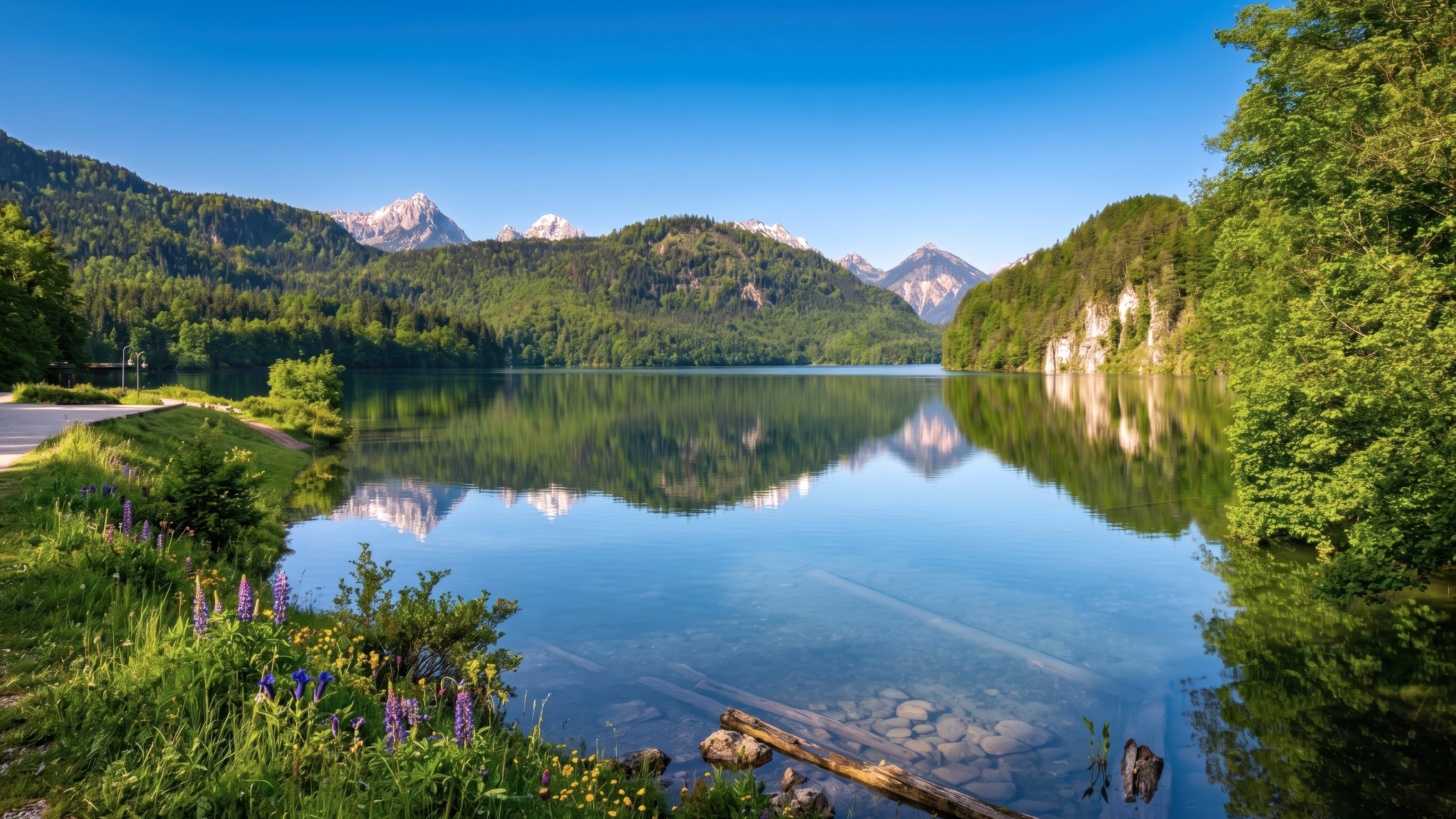
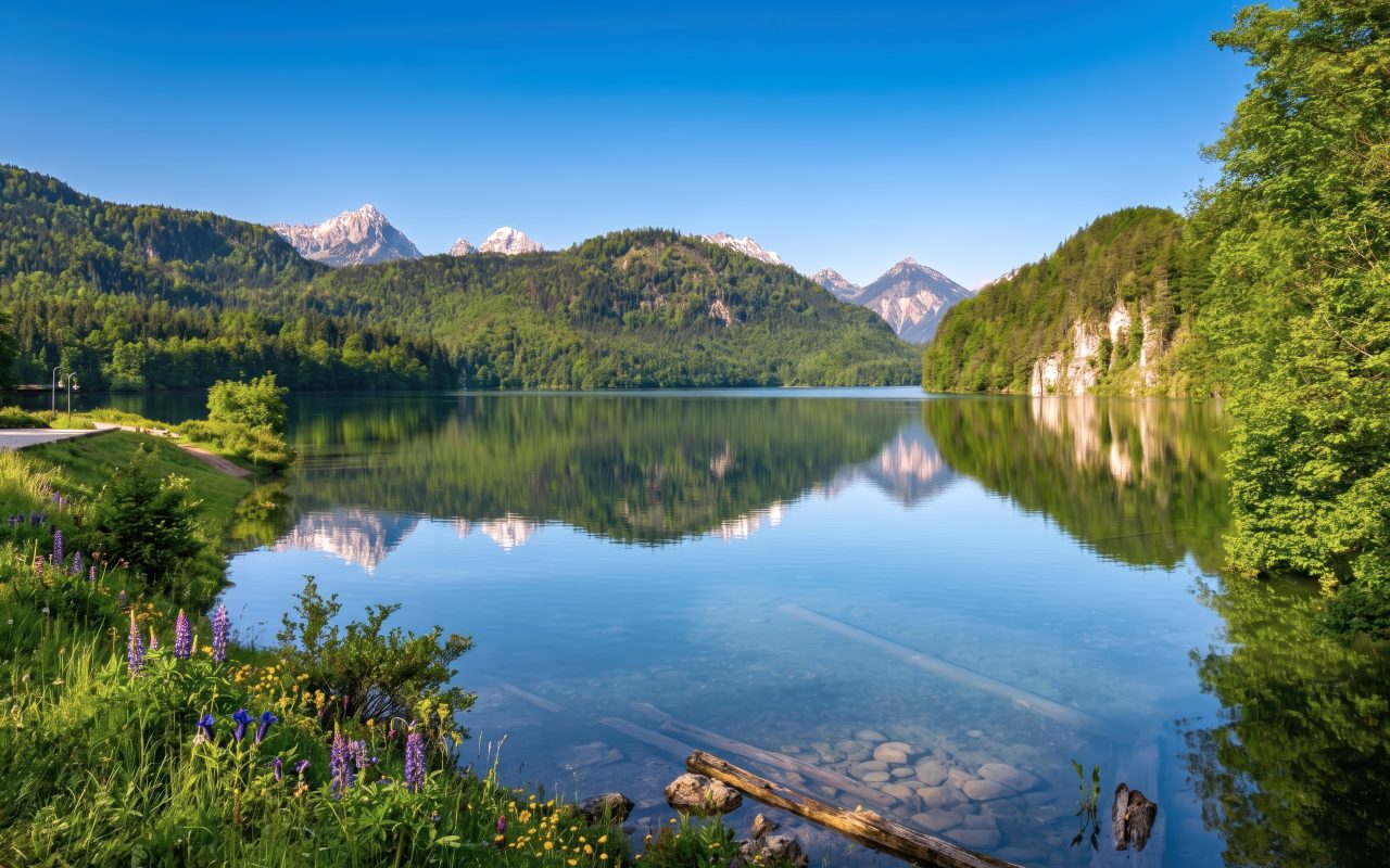
Alpsee circular route
The official circular route is listed at around 5.2 kilometres and about 1.5 hours. It leads around the lake directly below the royal castles.
 14.3 km
Schwangau circular route
The official loop measures 14.3 kilometres and connects Brunnen, Mühlberg, the Tegelberg valley station and Hohenschwangau.
 1,720 m
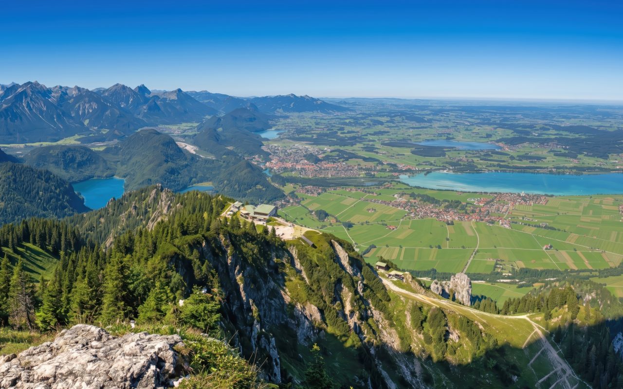
Tegelberg
The mountain station of the Tegelbergbahn is at around 1,720 metres; the Branderschrofen as the highest point of the massif reaches 1,881 metres. From above, views open to the royal castles and the foothills of the Alps.
Learn more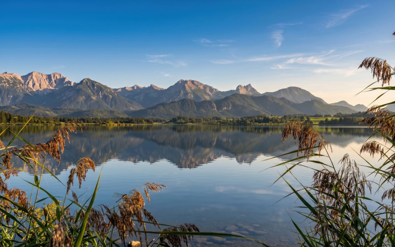 60+ km trails
Schwanseepark
Today, more than 60 kilometres of hiking trails run through Schwanseepark and the Alpsee basin. The historic park landscape is well suited for quiet, longer walks.
What is practical about these four destinations
Alpsee fits well if you want a quiet day by the water. The circular route is manageable and can be included in the day without much effort.
If you want to cover more distance, the Schwangau circular route is the more obvious choice. It connects Mühlberg, the Tegelberg valley station and Hohenschwangau into a larger loop.
Tegelberg is more the destination for views, Schwanseepark more for quiet walking routes. This mix is exactly what makes Schwangau interesting beyond castle visits.
Why this is pleasant from Mühlberg
You stay quietly and still do not have to plan long routes for many destinations around Schwangau.
That makes the stay varied without every day having to look like a fixed programme.
Seasonal notes on the routes
The four destinations mentioned look different depending on the season. In spring, the Schwangau circular route can be damp in lower sections while the slopes above still carry patches of snow. The Alpsee circular route is usually walkable early because it is almost level and only partly shaded. Only early summer brings the mountain water in the streams around Schwangau to swell, which becomes visible at individual crossings.
In high summer, the routes around Alpsee and Schwanseepark are pleasantly shaded; on hot days the official circular route around Alpsee can already be busy in the morning. Autumn is the quieter season: the Tegelbergbahn runs into late autumn, but snow arrives earlier on the mountain than in the valley. In winter, according to the municipality, around 50 kilometres of winter hiking trails are cleared in Schwangau; not every summer trail is then walkable, and avalanche conditions must be observed on uncleared routes.
Further routes and a bad-weather idea
Alongside the four destinations named above, there are further routes around Schwangau that fit individual days. The GEOgrenzGÄNGER hiking route is an approximately 16-kilometre loop that leads from Schwangau via the Ziegelwies forest experience centre to Pinswang in Tyrol and back. According to its own information, the municipality of Schwangau has around 120 kilometres of hiking trails, so the destinations named in the first block are only a selection.
The Pöllat Gorge below Neuschwanstein Castle is often mentioned as a nature destination; it has been closed since a rockfall in October 2020 and is not accessible until further notice. Marienbrücke over the gorge is also temporarily closed for safety reasons, regularly in winter because of snow and ice. If you are looking for a reliable viewpoint, it is better to plan the bridge only as an addition, not as the main destination of the day. As a bad-weather alternative, the Königliche Kristalltherme in the centre of Schwangau offers thermal brine pools, saunas and a wellness area; it suits days when walking routes and views are not enjoyable.
Keep an eye on weather and mountain weather
Schwangau lies at the edge of the foothills of the Alps, and that shapes the weather. In spring and autumn, foehn can occur: in the valley it may first feel friendly and warm, but on the mountain it can become very windy, and weather changes often follow within one or two days. Anyone planning a Tegelberg day or a longer loop should therefore check a mountain weather forecast beforehand, for example from the German Alpine Club or specialised mountain weather portals.
Thunderstorms occur more often in summer in the late afternoon. Early start times help, especially for routes with exposed sections or longer ascents. In stable weather, Alpsee and Schwanseepark are straightforward; the Schwangau circular route requires a little more time, but remains manageable. Sturdy footwear, a wind- and rainproof layer and enough to drink are sensible even with a friendly forecast, because the weather in the foothills of the Alps can change faster than it first appears in the valley.
Further articles
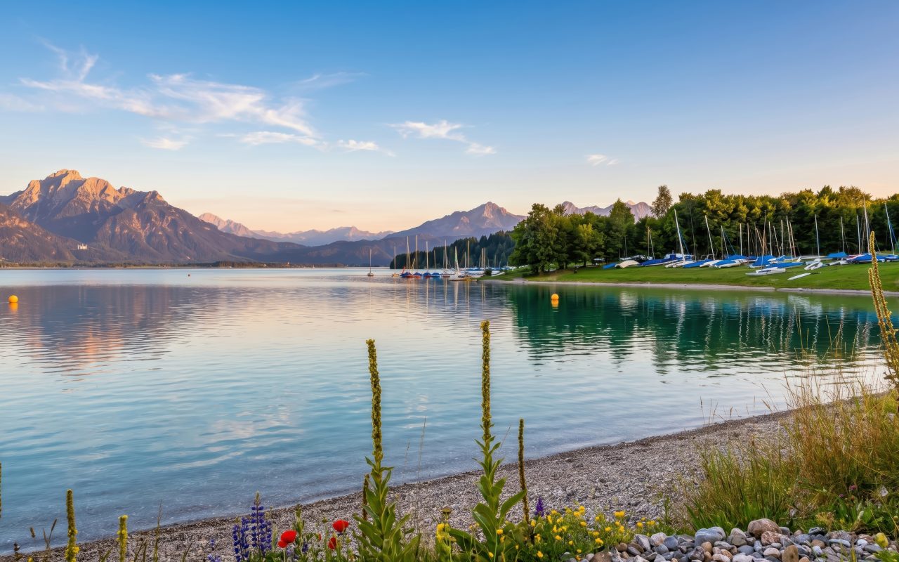
Forggensee
Reservoir on the Lech with boat trips in summer and wide open space in winter. A separate article for days by the water.
Learn more Hopfensee
Small pre-Alpine lake with promenade in Hopfen am See. Separate article with notes on the circular route and quiet hours.
Learn more Tegelberg
Schwangau’s local mountain with cable car to 1,720 m. Separate article with notes on the cable car, routes and season.
Learn more